CASE STUDY / GIS & automation
GPX Batch Converter
From GPS files to layers ready for analysis.
- Status
- Plugin published in the QGIS catalogue
- Contribution
- Independent project · Design and development
- Technologies
- Python · PyQGIS · GDAL
- Reference
- 1.3.0 documented in the repository

- 01GPX files
- 02Select and convert
- 03Layers + report
TRY THE PROJECT
From documentation to practice.
Try it in QGIS using a copy of a GPX file without personal data. These steps describe the workflow; they do not run the plugin on this website.
01Install and open
In the QGIS plugin manager, search for GPX Batch Converter. Open the tool and select your test GPX files.
02Choose the output
Select the available waypoints, routes or tracks, the output format and a destination folder. Run the conversion.
03Check the result
Open the generated layers, compare them with the original GPX and review the processing report and coordinate attributes.
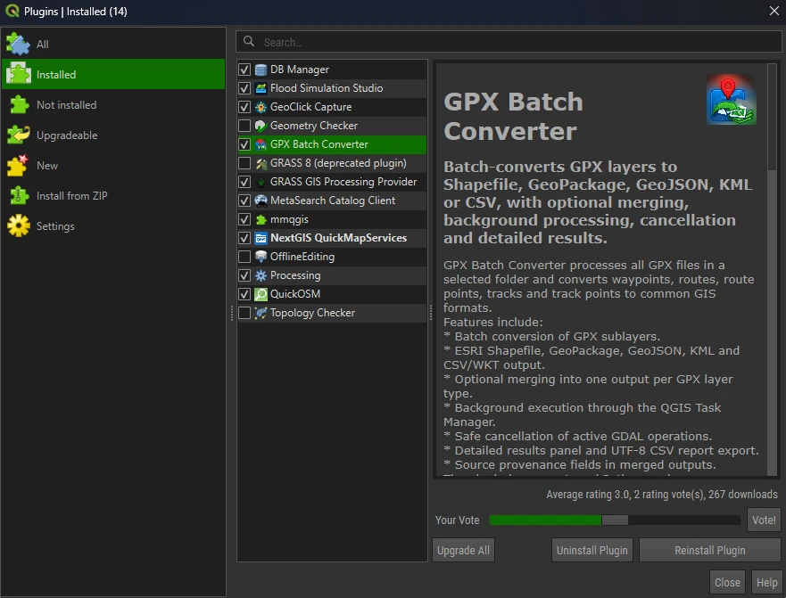
The tool in QGIS
Actual screenshot of the plugin manager: tool identification and feature descriptions.
The problem
Field collection may produce several GPX files with tracks, routes and waypoints. Preparing each file separately requires repeated operations and makes data provenance harder to track.
The approach
A QGIS plugin with batch processing, layer selection, background conversion and an option to merge results. The workflow records the outcome of each operation and preserves provenance when merging.
The verifiable result
The implementation documents conversion to Shapefile, GeoPackage, GeoJSON, KML and CSV, processing-report export and WGS 84 coordinate attributes. The plugin is listed in the official QGIS catalogue.
Limitations and status
Available layers depend on the GPX file contents. Coordinate attributes reflect the geometry at conversion time. We do not claim published measurements of time saved or user numbers.
Description based on public documentation reviewed on 9 October 2026. Versions and features may change.
Have a similar process?
We can review your project's data, rules and users, and propose a tailored solution.